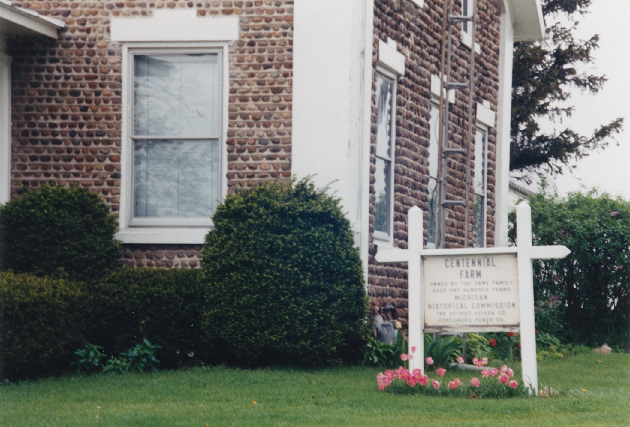
Building date: 1846
Original use:
Corner structures:
Mortar application and content:
Types and uses of stones:
Types and choice of windows:
Structures with similar masonry details:
Masons who worked on building:
Unique features:
Map views courtesy Google Maps. Address is Google Earth confirmed; 42°48'32.97"N 83°31'54.01"W. Current owner of record, Osgood Farm LLC as of the 2019 Tax Roll.
Town of Bedford and Monroe County Maps.
1890 photograph of the Osgood House. Humanities Magazine January/February 1992, page 27.
 Bed-1 744 Samaria Rd 1.jpg ¹ |  Bed-1 744 Samaria Rd 2.jpg ¹ | 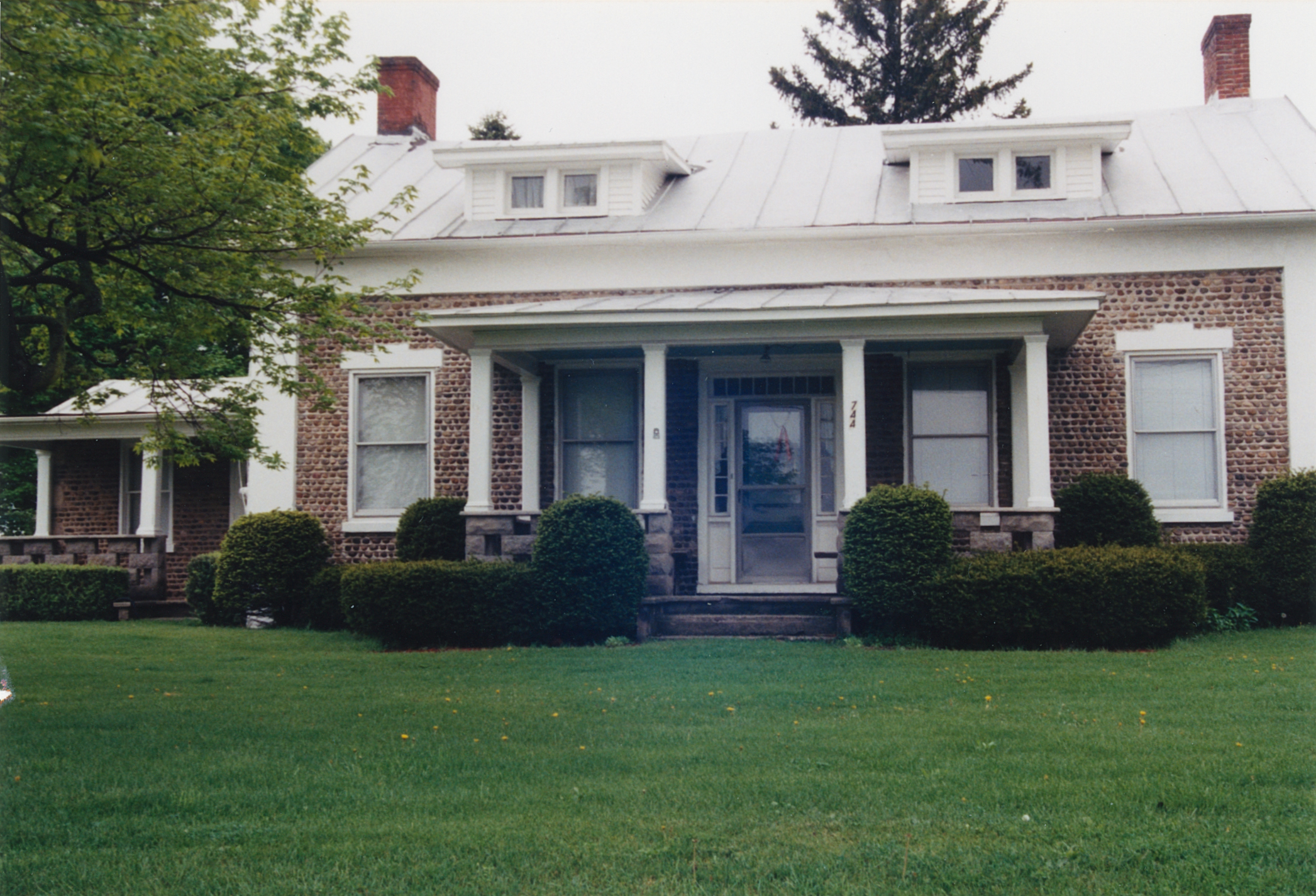 Bed-1 744 Samaria Rd 3.jpg ¹ | 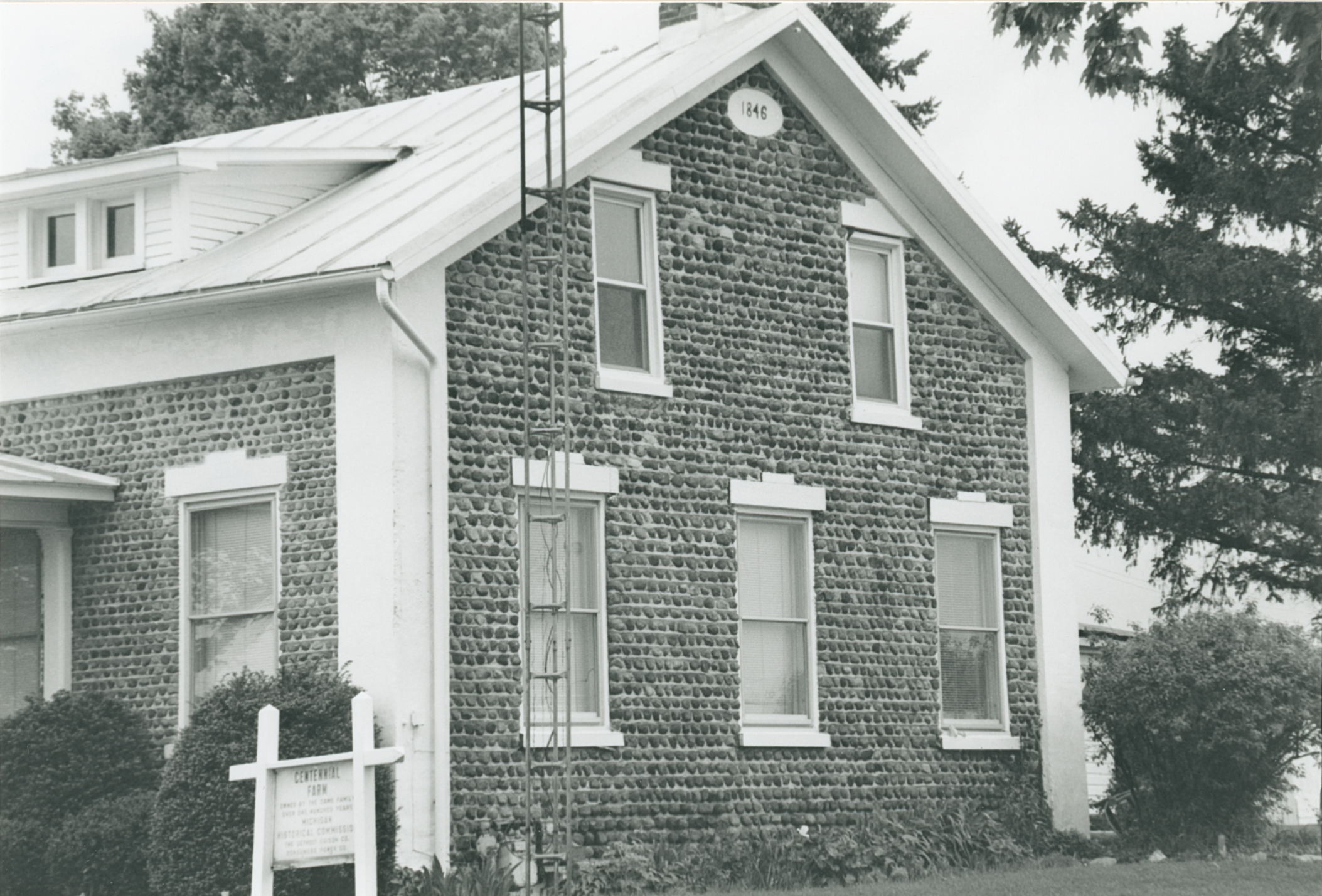 Bed-1 744 Samaria Rd 4.jpg ¹ |
¹ Photography courtesy Martin and Sheila Wolfish.
